Mapping Yale, Part Three
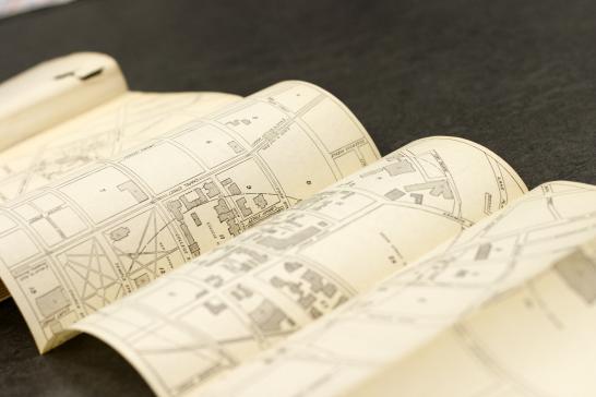
By 1922 Yale had abandoned the perspective view of the campus in favor of a schematic, six-panel foldout drawn by Albert B. Hill, Class of 1869 (Sheffield Scientific), a New Haven civil engineer. It showed every building and included concentric circles marking the distance from Woodbridge Hall in quarter-miles. A detailed key was published on the verso. But the map, which is just over 27 inches wide, was a somewhat cumbersome insert in the volumes of the Bulletin series.
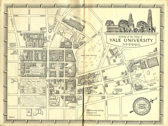
In 1938 Yale adopted this handsome map of “Buildings at the Center of Yale University,” which fit across a single spread in the Bulletin series. It was drawn by Robert W. Galvin, who was a student at the Yale School of Art in the mid-1930s and worked for a few years as an assistant to Yale’s first University Printer, Carl P. Rollins. The map’s decorative border represents the Yale Fence; the vignette shows Connecticut Hall on the left and Harkness Tower on the right. Galvin later worked as a cartographer for the U.S. Army Map Service. Clearly a skilled calligrapher, he also designed several typefaces, including “Galvin” for the Justowriter, a machine that combined an electronic typewriter keyboard with a recorder to produce justified type.
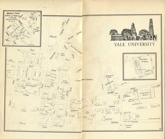
Galvin’s map, with modifications, remained in use in the Bulletin series until 1981, when it was replaced by a map drawn by Robert Lee Williams, a lecturer in geography and director of Yale’s Map Laboratory. It too fit on a single spread, but the Medical Center and Divinity School were included in small insets.
[See the "Image Galleries" link to the left for details of these and previous maps.]
- Log in to post comments.